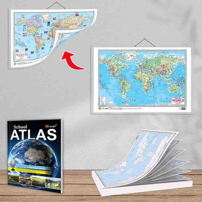
SMALL - 100 WORLD RIVER OUTLINE MAP FOR SCHOOL, 2 IN 1 WORLD POLITICAL AND PHYSICAL MAP IN ENGLISH and SCHOOL ATLAS (ENGLISH) - MAPLITHO | 1 map pad + 1 map chart + 1 school atlas book |2-in-1 Political and Physical Map for School Student Paper Print(30 inch X 20 inch)
Quick Overview
Product Price Comparison
"Introducing Gowoo's combo of SMALL - 100 WORLD RIVER OUTLINE MAP FOR SCHOOL, 2 IN 1 WORLD POLITICAL AND PHYSICAL MAP IN ENGLISH and SCHOOL ATLAS (ENGLISH) - MAPLITHO. This map is a simplified representation of rivers worldwide, explicitly designed for school students. It provides an outline of significant rivers across different continents. This map aims to help students understand the global distribution of rivers and familiarise them with their names and locations. The measuring small 100-world river outlines map size is 7*8 inch on the map pad. The school atlas maplitho paper size is 8.5*11 inch, and the 2in1 political and physical map size is 20*30 inch. This chart and map are perfect for student use. The map is easy to read and provides a basic overview of the world's major rivers, making it a helpful resource for geography lessons. This map chart combines the world's political and physical features in a single visual representation. It is intended for school students and is available in English. The political aspect of the map shows the boundaries of countries ,and their capitals . This helps students understand the political divisions and the locations of different nations across the globe.Additionally, the physical aspect of the map illustrates the natural features of the Earth's surface, such as mountains, rivers, deserts, and oceans. It provides a visual depiction of the Earth's topography, helping students grasp the different landforms and bodies of water worldwide. The political and physical aspects of this 2-in-1 map allow students to understand the world's geography comprehensively. It aids in learning about countries, their capitals, and physical characteristics, making it an invaluable resource for geography lessons and general knowledge.: The School Atlas is a collection of maps designed specifically for students. It is available in English and uses a map printing technique called ""Maplitho"" to ensure clarity and ease of use. This atlas is a valuable tool for students to explore and understand various aspects of geography.The atlas includes many maps covering different continents, countries, regions, and thematic topics. It provides detailed information on political boundaries, major cities, rivers, mountains, and other important geographical features. Simple explanations and legends accompany the maps to assist students in interpreting the information accurately.The School Atlas aims to enhance students' geographical knowledge and develop map-reading skills. It is a comprehensive resource that helps students explore the world, learn about different cultures, and gain a deeper understanding of global geography. Maplitho printing ensure the maps are clear and easily comprehended, making it an ideal companion for school students."

